Deadly tornado outbreak leaves extensive damage in Tennessee, Kentucky
Deaths have been reported in the Clarksville and Nashville areas in Tennessee after twisters ripped across the South on Saturday.
NASHVILLE, Tenn. – A powerful storm system that is bringing snow, wind and heavy rainfall across the eastern U.S. this weekend also brought with it deadly tornadoes that tore across parts of the South on Saturday.
The Storm Prediction Center received more than a dozen reports of tornadoes in Kentucky and Tennessee on Saturday, triggering the FOX Weather Center to declare the event a tornado outbreak.
Officials in Montgomery County said they have confirmed at least three deaths and nearly two dozen injuries as a result of a tornado that tore through the Clarksville area, one of the largest cities in Tennessee. Officials in Nashville confirmed there have been at least three deaths there after a tornado ripped across the northern side of the metro area.

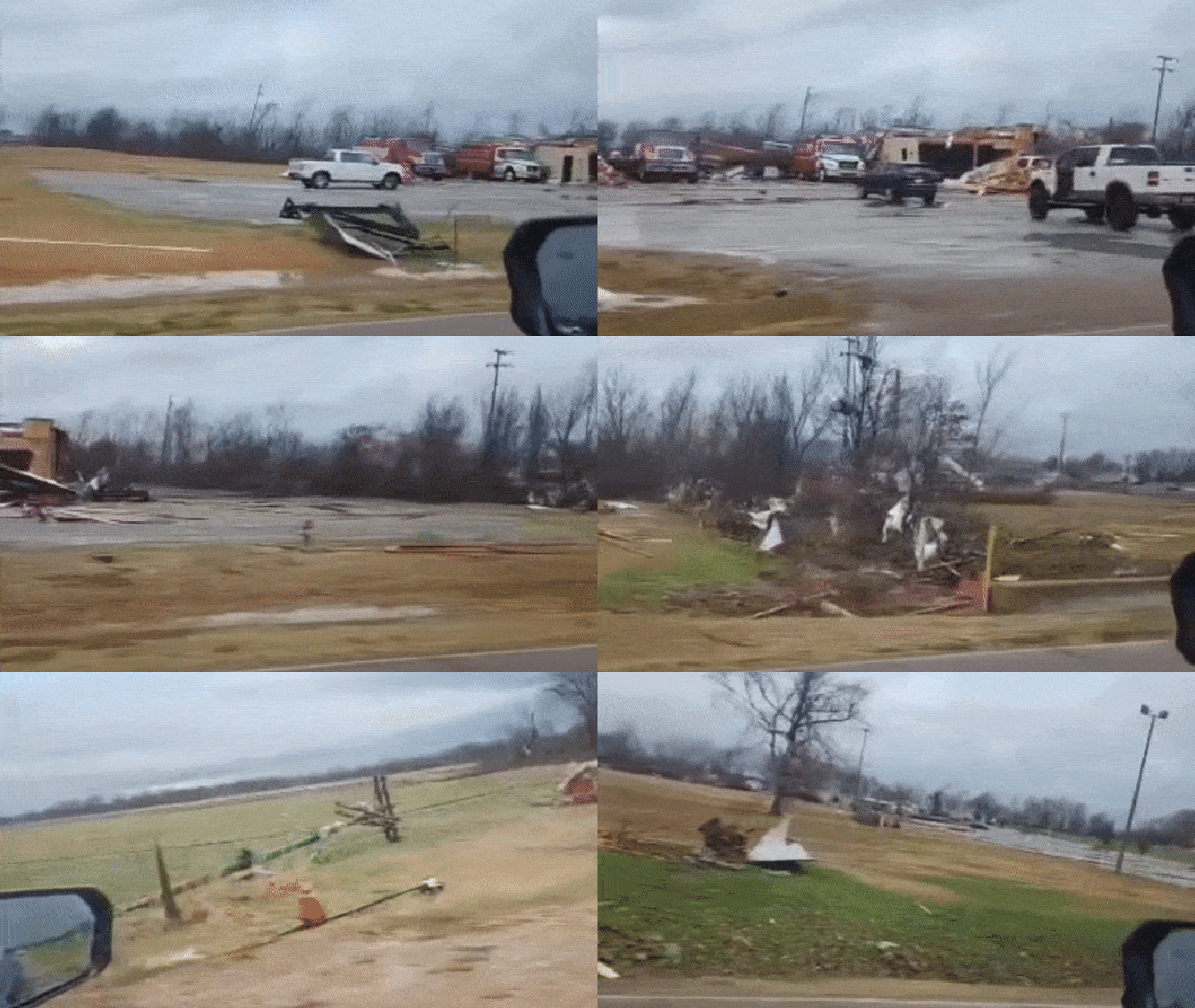
Tornado damage in Rutherford, TN. Dec. 9, 2023.
(Gabriel Lindsey / Facebook / FOX Weather)
First damage reported in Rutherford, Tennessee
The first Tornado Warning was issued about 12:30 p.m. local time and was in effect for communities such as Rutherford, Dredson and Gleason in the northwestern part of the Volunteer State. The warning was later declared a "Particularly Dangerous Situation" due to radar and observation reports.
The impacted area is about a two-hour drive outside of Nashville, and the supercell stayed together long enough that warnings were issued in southern Kentucky.
Emergency management in Gibson County was quick to report damage from a tornado and described it as being "significant."
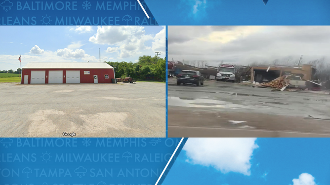
Photos and videos taken after the storm showed flipped vehicles, extensive tree damage and a roof that was torn off a fire station.
Officials in Gibson County did not immediately report if there were any injuries tied to the severe storms.
"Numerous poles downed or broken in Rutherford area," Gibson Electric Membership Corporation posted on Facebook, adding nearly 4,500 people were without power in the community and 60,000 in the state, according to data from PowerOutage.us.

Rutherford, Tennessee tornado damage before and after of a fire station
(Google Maps/Olivia Marie Walker / FOX Weather)
Several dead, dozens injured near Tennessee-Kentucky line
The same supercell is credited for producing a tornado in Clarksville, which meteorologists tracked into the Blue Grass State.
Several homes were destroyed, and dozens of people were either injured or killed in the Clarksville area because of the storm.
"This is a day that nobody wanted or expected, but this is a day where our community shines," said Joe Pitts, mayor of Clarksville. "So, please, if you need help, call 911, and help will be on the way immediately. But if you can, please stay home. Do not get out on the road."
According to officials, ambulances from outside the town responded to the community but said it was too early in their search and rescue efforts to determine the total number of those needing help after the storm.
A traffic camera caught video of the storm passing through the northern part of the Volunteer State.
Traffic camera captures supercell moving through north Tennessee
A traffic camera in Clarkesville, Tennessee, captured a severe thunderstorm with a likely embedded tornado moving through the northern part of the state on Saturday.
A significant tornado debris signature was detected on radar, which is an indication that the twister was likely strong as it traveled northeast into Kentucky.
Weather spotters reported widespread damage around the town of Gutherie in Todd County, Kentucky.
CDE Lightband, a municipal utility that provides electricity, digital TV, internet and phone service to customers in the Clarksville area reported significant disruptions to its services.
Nashville-area tornadoes
Storms developed close enough to downtown Nashville that tornado sirens were sounded, and tornado warnings were issued around the metro. Officials have confirmed at least three deaths in the metro area as a result of the severe storms.
One of the hardest hit communities appeared to be Hendersonville, which was placed under a Tornado Emergency on Saturday evening.
Initial reports indicated cars were flipped, and several structures collapsed during a powerful tornado.
Video from nearby Madison showed what appeared to be an explosion from an industrial area after the storm passed through.
Search and rescue operations were just beginning on Saturday evening as night fell, meaning the scope of the disaster likely won't be fully understood until first daylight.
Storms trek eastward
The concern for tornadoes, damaging winds, large hail and heavy rainfall continues to push eastward.
A staunch cold front will allow for storms to continue overnight and produce a renewed round of activity on Sunday.
HERE’S WHAT THE ‘HATCHED AREA’ ON A SEVERE WEATHER MAP MEANS

(FOX Weather)
Sunday impacts
By Sunday, the rain and windy conditions will be the big weather story across the South and much of the eastern U.S. Areas in far northeastern Georgia, along with parts of North Carolina and Virginia, could see up to 3 inches of rainfall by Monday.

(FOX Weather)
The FOX Forecast Center said the threat of strong to severe thunderstorms will still exist by Sunday as the system shifts farther east, stretching from Tallahassee, Florida, across the southeast and into the mid-Atlantic.
The biggest threats are damaging winds and a few brief tornadoes, according to the SPC.


No comments: