What to expect in tropics as hurricane season enters October
The FOX Forecast Center is monitoring the Gulf of Mexico, Caribbean Sea and Atlantic Ocean for cyclones that will be named Sean, Tammy, Vince and Whitney. The hurricane season is considered to be worse in September than in October
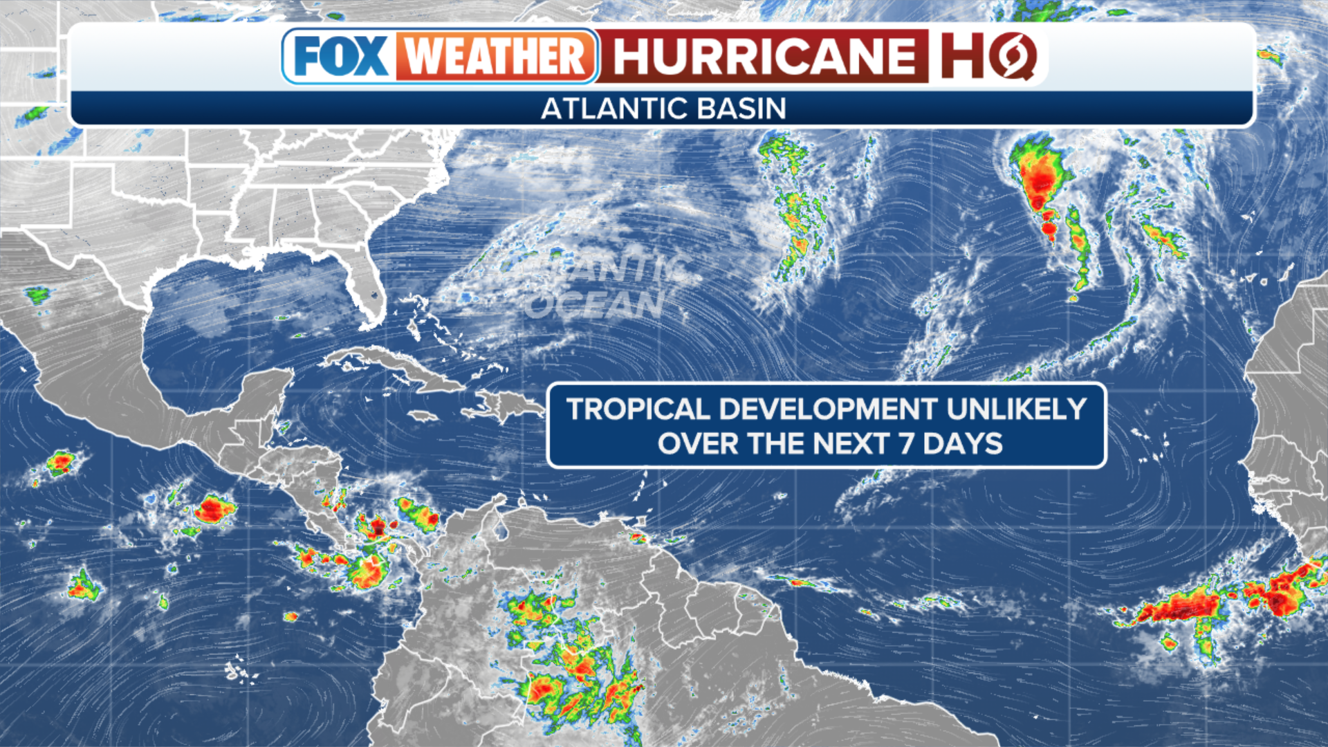
The busy Atlantic basin hurricane season is in its home stretch, but that does not mean October will see a lack of tropical cyclone activity that could impact the U.S. coastline.
The month usually produces three named storms and one hurricane that reaches major status with winds of at least 111 mph.
During the past couple of decades, October has seen significant hurricanes such as Michael (2018), Matthew (2016) and Wilma (2005).
Unlike during the peak months of August and September, the hotbed of formation zones decrease in coverage in October as more conditions that are hostile to development start to take hold ahead of winter.
WHEN IS THE TYPICAL LAST HURRICANE STRIKE ON THE US COAST?

This map shows where tropical cyclone activity tends to occur during October. The data are shown as the combined number of tropical depressions, tropical storms and hurricanes whose centers pass within 125 miles of a point on the map during a 100-year period. The analysis is based on data from the 72-year period from 1950 to 2021 but normalized to 100 years.
(FOX Weather)
No season is an exact carbon copy of another, and the status of an El Niño or La Niña can dictate how busy the month can be.
Typically, when El Niño weather patterns are in control during the fall, the basin nearly shuts down due to cooler water temperatures and hostile atmospheric winds.
Historically, Octobers dictated by El Niños only produce one named storm, while La Niña or neutral conditions lead to more development.
Early indications for October 2023
October is starting out with two tropical cyclones in the basin – Philippe and Rina. The future of both cyclones is complicated due to their proximity to each other.
Once the storms move out of the picture, the Atlantic basin will return to a state of quiet that it really hasn’t seen since mid-August.
At about that time, an expected wave of upward motion will approach the eastern Pacific, which could enable the waters off Mexico and Central America to become more active.
El Niño patterns are known to produce extremely warm water in the region, which is one of the ingredients conducive to tropical cyclone development.
(FOX Weather)
Cyclones, especially during the months of October and November, need to be monitored closely as low-pressure systems over North America can help pull the features north and northeastward toward landmasses.
During these landfall events, moisture can reach the Southwest U.S., Texas and even Florida.
On rare occasions, if the cyclone can maintain organization over Central America, it can emerge in the Atlantic basin and reorganize into a formidable storm system. This has only happened a handful of times during the modern satellite era.
As the favorable upward motion pattern moves eastward from the Pacific into parts of the Atlantic basin, forecasters will closely monitor the region for development.
If any additional cyclones reach tropical storm status in the Atlantic, they’ll take the names Sean, Tammy, Vince and Whitney.

Here is the list of names for the 2023 Atlantic Hurricane Season.
(FOX Weather)
7 WEATHER CHANGES TO EXPECT IN OCTOBER
The Gulf of Mexico and the Caribbean are usually hotspots for development during October, as waters are still warm, and a lack of shear can make the locations suitable for development.
Aside from Hurricane Idalia, which developed in the northwest Caribbean in August and struck Florida’s Big Bend, the Gulf of Mexico and the Caribbean have been void of significant tropical cyclone activity during the 2023 season.
Seeing reduced activity in these parts of the basin is common during El Niño events. The Atlantic has not had the same fate, with 15 storms that have traversed the ocean.
If the basin continues to defy the typical El Niño standard of reduced cyclone activity, it is likely the busy pace of formations will continue as water temperatures remain sufficient to support tropical storms and hurricanes.
The hurricane season runs through November 30, but during the final month of the season, the basin sees a significant decrease in activity as weather patterns become less conducive for formation.
During a typical year, the Atlantic basin only reports one named storm during November, which is similar to the amount of activity seen during the month of June.
If the season were to end without additional development, it would be considered a fairly active year with 18 storms and six hurricanes. During an average season, only 14 named storms form, and seven strengthen into at least a Category 1 cyclone.


No comments: